
Carrog topographic map
Interactive map
Click on the map to display elevation.
About this map
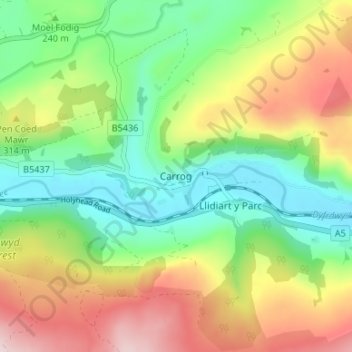
Name: Carrog topographic map, elevation, terrain.
Location: Carrog, Denbighshire, Wales, LL21 9AW, United Kingdom (52.96307 -3.34476 53.00307 -3.30476)
Average elevation: 265 m
Minimum elevation: 121 m
Maximum elevation: 485 m
Other topographic maps
Click on a map to view its topography, its elevation and its terrain.
Ruthin
United Kingdom > Wales > Denbighshire
Ruthin, Denbighshire, Wales, LL15 1BU, United Kingdom
Average elevation: 162 m
St Asaph
United Kingdom > Wales > Denbighshire
St Asaph, Denbighshire, Wales, LL17 0RF, United Kingdom
Average elevation: 125 m
Denbigh
United Kingdom > Wales > Denbighshire > Denbigh
Denbigh, Denbighshire, Wales, LL16 3UN, United Kingdom
Average elevation: 102 m