Geolocate

Cockfield topographic map

Click on the map to display elevation.

About this map

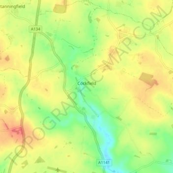
Name: Cockfield topographic map, elevation, terrain.

Location: Cockfield, Babergh, Suffolk, England, United Kingdom (52.13211 0.75738 52.17790 0.81839)

Average elevation: 85 m

Minimum elevation: 59 m

Maximum elevation: 107 m

Other topographic maps

Click on a map to view its topography, its elevation and its terrain.

Sudbury

United Kingdom > England > Suffolk > Babergh

Average elevation: 54 m

Gear up for your next adventure:

🧭Compass - Navigation compasses for outdoor exploration
👄SPF Lip Balm - Prevent sun and wind-burnt lips on mountain ridges
🔌Fast Charging Adapters - Quickly top up all your gear before heading back into the field
☀️Portable Solar Chargers - High-efficiency panels to hang on your backpack while walking
🕶️Polarized Sunglasses - UV protection sunglasses for outdoors

As an Amazon Associate, this site earns from qualifying purchases at no extra cost to you.