Geolocate

Istanbul topographic map

Click on the map to display elevation.

About this map
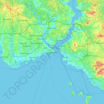
Name: Istanbul topographic map, elevation, terrain.

Location: Istanbul, Fatih, Istanbul, Marmara Region, 34122, Turkey (40.84638 28.81587 41.16638 29.13587)

Average elevation: 57 m

Minimum elevation: -2 m

Maximum elevation: 429 m

Other topographic maps

Click on a map to view its topography, its elevation and its terrain.
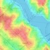
Balat Mahallesi

Turkey > Fatih

Average elevation: 33 m

Balat Mahallesi

Turkey > Fatih

Average elevation: 33 m

Gear up for your next adventure:

🔥Ferrocerium Rod Fire Starters - Reliable fire lighting in wet or windy conditions without matches
🧊Insulated Cooler Bags - Keep food fresh for day trips to remote geographic sites
🖼️Scratch-off Australia Map - Track the regions and peaks you have explored geographically
🚴Cycling Backpacks - Backpacks for cyclists
🍳Ultralight Camping Stoves - Boil water quickly for meals using minimal fuel

As an Amazon Associate, this site earns from qualifying purchases at no extra cost to you.