Geolocate

Rothwell topographic map

Click on the map to display elevation.

About this map

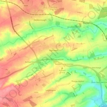
Name: Rothwell topographic map, elevation, terrain.

Location: Rothwell, North Northamptonshire, England, United Kingdom (52.40352 -0.84283 52.43758 -0.73461)

Average elevation: 117 m

Minimum elevation: 66 m

Maximum elevation: 159 m

Gear up for your next adventure:

🎧Bluetooth Outdoor Earbuds - Listen to navigation cues or podcasts during long solo treks
📣High-Decibel Survival Whistles - Signaling tool for rescue that carries much further than a human voice
🧴Sunscreen SPF - Sun protection for outdoor activities
🍶Collapsible Water Bottles - Save space in your pack as you consume your water supply
🧣Merino Neck Gaiters - Versatile headwear for warmth, sun protection, or dust filtering

As an Amazon Associate, this site earns from qualifying purchases at no extra cost to you.