Geolocate

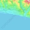
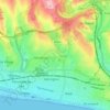
Brighton topographic map

Click on the map to display elevation.

About this map
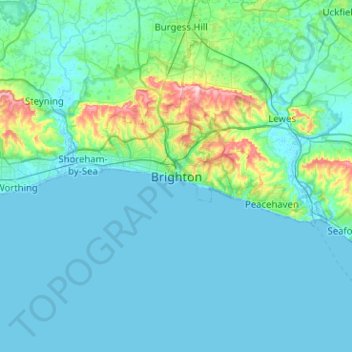
Name: Brighton topographic map, elevation, terrain.

Location: Brighton, Brighton and Hove, England, BN1 1HJ, United Kingdom (50.66146 -0.30006 50.98146 0.01994)

Average elevation: 28 m

Minimum elevation: -2 m

Maximum elevation: 252 m

Other topographic maps

Click on a map to view its topography, its elevation and its terrain.
Brighton

United Kingdom > England > Brighton and Hove

Average elevation: 64 m

Hove Park

United Kingdom > England > Brighton and Hove > Hove

Average elevation: 53 m

Hove

United Kingdom > England > Brighton and Hove

Average elevation: 54 m

BN2 4PG

United Kingdom > England > Brighton and Hove > Brighton

Average elevation: 93 m

BN2 0QU

United Kingdom > England > Brighton and Hove > Brighton

Average elevation: 44 m

Gear up for your next adventure:

🧊Insulated Stainless Steel Flasks - Keep water cold for 24 hours in the heat or coffee hot in the cold
🧭Global Orienteering Compass - High-precision liquid-filled compasses for accurate map reading and navigation
🧯Animal Deterrent Spray - Safety spray for wildlife
📣High-Decibel Survival Whistles - Signaling tool for rescue that carries much further than a human voice
🔋Solar Power Banks - Charge your phone and GPS using the sun while deep in the bush

As an Amazon Associate, this site earns from qualifying purchases at no extra cost to you.