Geolocate

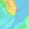
Buka topographic map

Click on the map to display elevation.

About this map

Name: Buka topographic map, elevation, terrain.

Location: Buka, Buka District, Autonomous Region of Bougainville, Islands Region, 355, Papua New Guinea (-5.46023 154.50706 -5.00174 154.71333)

Average elevation: 12 m

Minimum elevation: 0 m

Maximum elevation: 445 m

Other topographic maps

Click on a map to view its topography, its elevation and its terrain.
Gear up for your next adventure:

🐍Snake Gaiters - Protection against snake bites
🏕️Camping Gear - Essential camping equipment
🥶Thermal Beanies - Warm hats for cold hikes
🕶️Polarized Sunglasses - UV protection sunglasses for outdoors
🔥Camping Stoves - Portable stoves for outdoor cooking

As an Amazon Associate, this site earns from qualifying purchases at no extra cost to you.