
Hamm topographic map
Interactive map
Click on the map to display elevation.
About this map
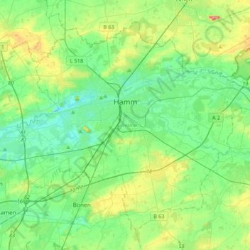
Name: Hamm topographic map, elevation, terrain.
Location: Hamm, North Rhine – Westphalia, Germany (51.57864 7.67477 51.74460 7.99744)
Average elevation: 75 m
Minimum elevation: 46 m
Maximum elevation: 156 m
Other topographic maps
Click on a map to view its topography, its elevation and its terrain.
Paderborn
Germany > North Rhine – Westphalia > Kreis Paderborn > Paderborn
Paderborn, Kreis Paderborn, North Rhine – Westphalia, Germany
Average elevation: 155 m