Geolocate

Middlesbrough topographic map

Click on the map to display elevation.

About this map
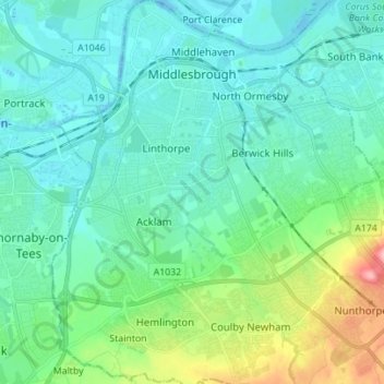
Name: Middlesbrough topographic map, elevation, terrain.

Location: Middlesbrough, Tees Valley, England, United Kingdom (54.51076 -1.28250 54.59140 -1.16067)

Average elevation: 26 m

Minimum elevation: -13 m

Maximum elevation: 131 m

Gear up for your next adventure:

🎒Dry Bags - Waterproof bags for outdoor gear
🦘Outback Survival Gear - Essential gear for Australian outback
🛰️Handheld GPS Units - Rugged GPS devices for tracking coordinates and elevation in the Australian bush
🪑Portable Backpacking Chairs - A comfortable seat for studying maps at the end of the day
📣High-Decibel Survival Whistles - Signaling tool for rescue that carries much further than a human voice

As an Amazon Associate, this site earns from qualifying purchases at no extra cost to you.