Geolocate

Cavehill topographic map

Click on the map to display elevation.

About this map

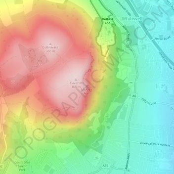
Name: Cavehill topographic map, elevation, terrain.

Location: Cavehill, County Antrim, Northern Ireland, BT15 5GL, United Kingdom (54.64816 -5.95069 54.64826 -5.95059)

Average elevation: 188 m

Minimum elevation: 24 m

Maximum elevation: 364 m

Other topographic maps

Click on a map to view its topography, its elevation and its terrain.

Gear up for your next adventure:

🎒Ultralight Backpacks - Lightweight packs for long hikes
🥤Hydration Packs - Hydration systems for hiking
🌿Flora and Fauna Field Guides - Identify the plants and animals you encounter on your route
🧊Insulated Stainless Steel Flasks - Keep water cold for 24 hours in the heat or coffee hot in the cold
👄SPF Lip Balm - Prevent sun and wind-burnt lips on mountain ridges

As an Amazon Associate, this site earns from qualifying purchases at no extra cost to you.