Geolocate

Roughtalley's Wood (South) & Epping Forest Woodland Burial Ground topographic map

Click on the map to display elevation.

About this map
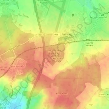
Name: Roughtalley's Wood (South) & Epping Forest Woodland Burial Ground topographic map, elevation, terrain.

Location: Roughtalley's Wood (South) & Epping Forest Woodland Burial Ground, Theydon Garnon, Coopersale, Epping Forest, Essex, England, CM16 6AD, United Kingdom (51.70497 0.14628 51.71075 0.15584)

Average elevation: 96 m

Minimum elevation: 58 m

Maximum elevation: 117 m

Gear up for your next adventure:

🔋Solar Power Banks - Charge your phone and GPS using the sun while deep in the bush
☀️Portable Solar Chargers - High-efficiency panels to hang on your backpack while walking
📡Portable Emergency Radios - Stay informed about weather warnings and bushfire alerts
🧼Biodegradable Outdoor Soap - Clean gear and yourself without harming the local ecosystem
🏕️Camping Gear - Essential camping equipment

As an Amazon Associate, this site earns from qualifying purchases at no extra cost to you.