Geolocate

Quantico topographic map

Click on the map to display elevation.

About this map
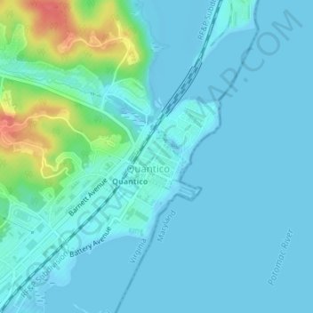
Name: Quantico topographic map, elevation, terrain.

Location: Quantico, Prince William County, Virginia, United States (38.52004 -77.29365 38.52562 -77.28666)

Average elevation: 11 m

Minimum elevation: -2 m

Maximum elevation: 66 m

Gear up for your next adventure:

🔥Windproof Plasma Lighters - USB rechargeable lighters that work in high-altitude winds
🚁Camera Drones with GPS - Capture aerial views of the landscape to compare with topo maps
🏫Topographic World Globes - 3D physical relief globes to understand global geography
📖Australian Bush Survival Books - Local knowledge on finding water and surviving the outback
🛌Sleeping Bags - Sleeping bags for outdoor camping

As an Amazon Associate, this site earns from qualifying purchases at no extra cost to you.