Geolocate

Middlesbrough topographic map

Click on the map to display elevation.

About this map
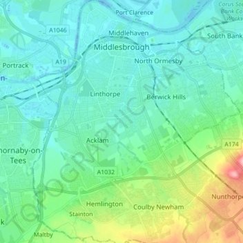
Name: Middlesbrough topographic map, elevation, terrain.

Location: Middlesbrough, Tees Valley, England, United Kingdom (54.51076 -1.28250 54.59140 -1.16067)

Average elevation: 26 m

Minimum elevation: -13 m

Maximum elevation: 131 m

Gear up for your next adventure:

📚Map Reading & Navigation Guides - Master the art of interpreting topographic contours and symbols
👣Snake & Scrub Gaiters - Protection against spinifex, mud, and snakes while walking off-track
🔭Compact Hiking Binoculars - Lightweight optics for scouting routes or birdwatching
🦟Insect Repellent - Protection against insects
🔑Heavy Duty Carabiners - Secure gear to the outside of your pack for easy access

As an Amazon Associate, this site earns from qualifying purchases at no extra cost to you.