
Make a donation
Gear up for your next adventure:
As an Amazon Associate, this site earns from qualifying purchases at no extra cost to you.
Paradise topographic map
Click on the map to display elevation.
Make a donation
Gear up for your next adventure:
As an Amazon Associate, this site earns from qualifying purchases at no extra cost to you.
Paradise
Paradise is located at 39°6′56″N 98°55′3″W / 39.11556°N 98.91750°W / 39.11556; -98.91750 (39.115445, -98.917428) at an elevation of 1,693 feet (516 m). Located in north-central Kansas 3.5 miles (5.6 km) west of U.S. Route 281 on Kansas Highway 18 (K-18), Paradise is 127 miles (204 km) northwest of Wichita, 233 miles (375 km) west of Kansas City, and 15 miles (24 km) north-northwest of Russell, the county seat.
Make a donation
Gear up for your next adventure:
As an Amazon Associate, this site earns from qualifying purchases at no extra cost to you.
About this map
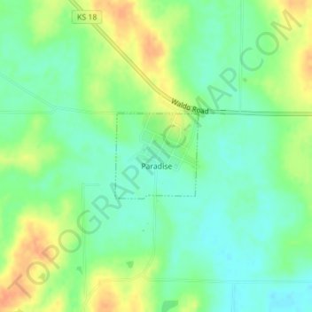
Name: Paradise topographic map, elevation, terrain.
Location: Paradise, Russell County, Kansas, United States (39.11077 -98.92306 39.11820 -98.91377)
Average elevation: 527 m
Minimum elevation: 510 m
Maximum elevation: 550 m
Make a donation
Gear up for your next adventure:
As an Amazon Associate, this site earns from qualifying purchases at no extra cost to you.