Geolocate

Kenai topographic map

Click on the map to display elevation.

About this map
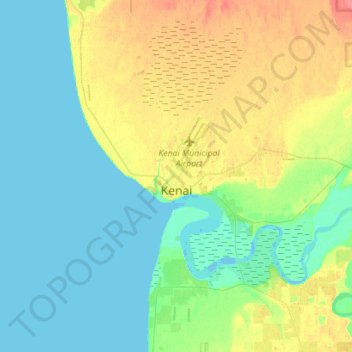
Name: Kenai topographic map, elevation, terrain.

Location: Kenai, Kenai Peninsula, Alaska, United States (60.51659 -151.35262 60.60370 -151.07224)

Average elevation: 16 m

Minimum elevation: -5 m

Maximum elevation: 50 m

Other topographic maps

Click on a map to view its topography, its elevation and its terrain.
Mount Mary

United States > Alaska > Kenai Peninsula

Average elevation: 915 m

Gear up for your next adventure:

🦯Adjustable Trekking Poles - Reduce impact on knees when descending steep topographic ridges
🧯Animal Deterrent Spray - Safety spray for wildlife
🧢Wide Brim Sun Hats - Maximum coverage for the face and neck while out in the open
🔪Multitools - Compact tools for outdoor use
🕯️Emergency Whistles - Safety whistles for hiking

As an Amazon Associate, this site earns from qualifying purchases at no extra cost to you.