Geolocate

Mickleham topographic map

Click on the map to display elevation.

About this map

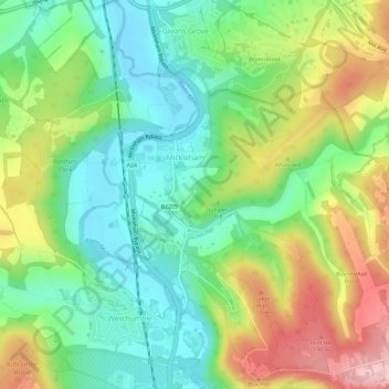
Name: Mickleham topographic map, elevation, terrain.

Location: Mickleham, Mole Valley, Surrey, England, United Kingdom (51.24975 -0.34926 51.28003 -0.29126)

Average elevation: 103 m

Minimum elevation: 32 m

Maximum elevation: 217 m

Gear up for your next adventure:

Altimeter Barometer Watches - Outdoor watches with built-in sensors to track altitude changes and weather shifts
📦Crushproof Equipment Cases - Safe transport for sensitive surveying and mapping instruments
🎒Hiking Backpacks - Backpacks designed for hiking and trekking
🔑Heavy Duty Carabiners - Secure gear to the outside of your pack for easy access
🍳Ultralight Camping Stoves - Boil water quickly for meals using minimal fuel

As an Amazon Associate, this site earns from qualifying purchases at no extra cost to you.