Geolocate

Homosassa Springs topographic map

Click on the map to display elevation.

About this map

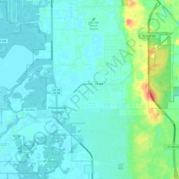
Name: Homosassa Springs topographic map, elevation, terrain.

Location: Homosassa Springs, Citrus County, Florida, United States (28.76403 -82.57963 28.86627 -82.48526)

Average elevation: 10 m

Minimum elevation: -1 m

Maximum elevation: 55 m

Other topographic maps

Click on a map to view its topography, its elevation and its terrain.

The Pocket

United States > Florida > Citrus County

Average elevation: 20 m

Gear up for your next adventure:

Altimeter Barometer Watches - Outdoor watches with built-in sensors to track altitude changes and weather shifts
🧣Merino Neck Gaiters - Versatile headwear for warmth, sun protection, or dust filtering
🔌Fast Charging Adapters - Quickly top up all your gear before heading back into the field
🎒3L Hydration Reservoirs - Hands-free drinking to stay hydrated on steep contour climbs
🏫Topographic World Globes - 3D physical relief globes to understand global geography

As an Amazon Associate, this site earns from qualifying purchases at no extra cost to you.