
Mansfield topographic map
Click on the map to display elevation.
About this map
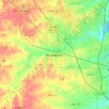
Name: Mansfield topographic map, elevation, terrain.
Location: Mansfield, Tarrant County, Texas, 76063, United States (32.51209 -97.18674 32.61612 -97.04678)
Average elevation: 195 m
Minimum elevation: 160 m
Maximum elevation: 231 m
Other topographic maps
Click on a map to view its topography, its elevation and its terrain.
Forest Hill
United States > Texas > Tarrant County > Forest Hill > Forest Hill
Average elevation: 195 m