

Haslemere topographic map
Click on the map to display elevation.
Haslemere
Many of the roads in the area originated as medieval tracks and owing to the local topography, are narrow, twisting and steep. The principal route through Haslemere is the A286, which connects the town with Godalming and Grayswood (to the north) and with Midhurst (to the south). The A287 runs south from Hindhead and passes through the west end of Shottermill, before joining the A286 close to Camelsdale. The main east–west road is the B2131, which links Haslemere to Chiddingfold and Petworth to the east, and to Liphook to the west.
About this map
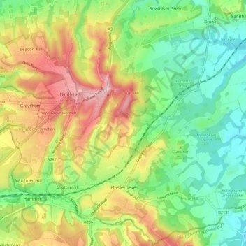
Name: Haslemere topographic map, elevation, terrain.
Average elevation: 150 m
Minimum elevation: 65 m
Maximum elevation: 273 m