Geolocate

Casterton topographic map

Click on the map to display elevation.

About this map

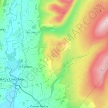
Name: Casterton topographic map, elevation, terrain.

Location: Casterton, Westmorland and Furness, England, United Kingdom (54.19447 -2.59751 54.24685 -2.45895)

Average elevation: 252 m

Minimum elevation: 35 m

Maximum elevation: 682 m

Other topographic maps

Click on a map to view its topography, its elevation and its terrain.

Gear up for your next adventure:

📱Shockproof Phone Cases - Extra protection for your smartphone against drops on rocky terrain
📻Handheld UHF Radios - Critical communication for groups in the Australian outback
🛠️Outdoor Repair Kits - Gear repair kits
🩹First Aid Kits - Emergency kits for hiking
📡Weather Radios - Emergency weather radios

As an Amazon Associate, this site earns from qualifying purchases at no extra cost to you.