
Hakkâri topographic map
Interactive map
Click on the map to display elevation.
About this map
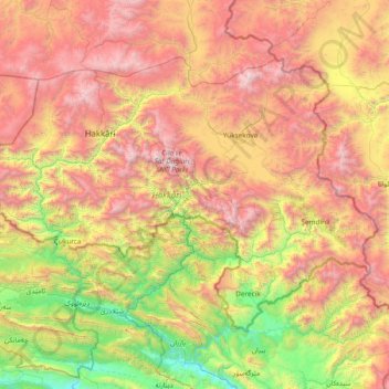
Name: Hakkâri topographic map, elevation, terrain.
Location: Hakkâri, Eastern Anatolia Region, Turkey (36.96270 43.30649 37.81058 44.81519)
Average elevation: 1,905 m
Minimum elevation: 443 m
Maximum elevation: 4,043 m