
Sahune topographic map
Interactive map
Click on the map to display elevation.
About this map
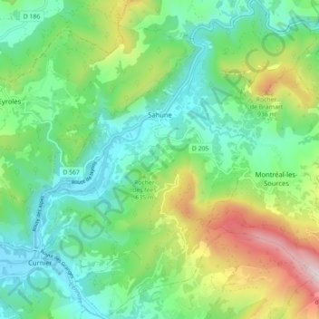
Name: Sahune topographic map, elevation, terrain.
Average elevation: 586 m
Minimum elevation: 317 m
Maximum elevation: 1,216 m
Other topographic maps
Click on a map to view its topography, its elevation and its terrain.
Archiane
France > Auvergne-Rhône-Alpes > Drôme > Châtillon-en-Diois > Archiane
Average elevation: 1,134 m