Geolocate

Strathbogie topographic map

Click on the map to display elevation.

About this map

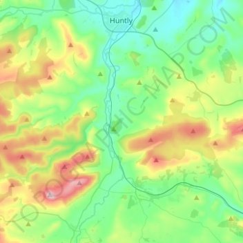
Name: Strathbogie topographic map, elevation, terrain.

Location: Strathbogie, Huntly, Aberdeenshire, Scotland, United Kingdom (57.32524 -2.83316 57.45845 -2.76949)

Average elevation: 239 m

Minimum elevation: 103 m

Maximum elevation: 563 m

Other topographic maps

Click on a map to view its topography, its elevation and its terrain.

Affleck

United Kingdom > Scotland > Aberdeenshire > Huntly

Average elevation: 135 m

Gear up for your next adventure:

📦Crushproof Equipment Cases - Safe transport for sensitive surveying and mapping instruments
🚴Cycling Backpacks - Backpacks for cyclists
📸Action Cameras - Record your journey across interesting topographic features in 4K
🧭Compass - Navigation compasses for outdoor exploration
🧺Fast-Dry Microfiber Towels - Large towels that pack down to the size of an orange

As an Amazon Associate, this site earns from qualifying purchases at no extra cost to you.