
Thank you for supporting this site ❤️
Make a donation
Make a donation
Gear up for your next adventure:
As an Amazon Associate, this site earns from qualifying purchases at no extra cost to you.
Petrinja topographic map
Click on the map to display elevation.
Thank you for supporting this site ❤️
Make a donation
Make a donation
Gear up for your next adventure:
As an Amazon Associate, this site earns from qualifying purchases at no extra cost to you.
About this map
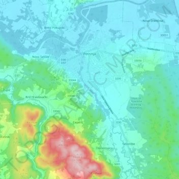
Name: Petrinja topographic map, elevation, terrain.
Location: Petrinja, City of Petrinja, Sisak-Moslavina County, Croatia (45.38460 16.25102 45.46559 16.36633)
Average elevation: 154 m
Minimum elevation: 93 m
Maximum elevation: 411 m
Thank you for supporting this site ❤️
Make a donation
Make a donation
Gear up for your next adventure:
As an Amazon Associate, this site earns from qualifying purchases at no extra cost to you.