
Charleroi topographic map
Interactive map
Click on the map to display elevation.
About this map
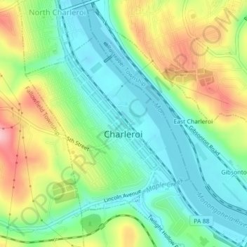
Name: Charleroi topographic map, elevation, terrain.
Location: Charleroi, Washington County, Pennsylvania, United States (40.12945 -79.91212 40.14858 -79.88861)
Average elevation: 283 m
Minimum elevation: 225 m
Maximum elevation: 386 m
Other topographic maps
Click on a map to view its topography, its elevation and its terrain.
South Strabane Township
United States > Pennsylvania > Washington County > South Strabane Township
South Strabane Township, Washington County, Pennsylvania, United States
Average elevation: 358 m