Geolocate

Ruckinge topographic map

Click on the map to display elevation.

About this map

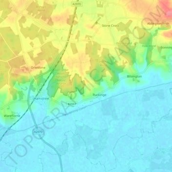
Name: Ruckinge topographic map, elevation, terrain.

Location: Ruckinge, Ashford, Kent, England, United Kingdom (51.03699 0.83993 51.10202 0.90112)

Average elevation: 23 m

Minimum elevation: -1 m

Maximum elevation: 73 m

Gear up for your next adventure:

📻Handheld UHF Radios - Critical communication for groups in the Australian outback
🩹First Aid Kits - Emergency kits for hiking
🧥Softshell Jackets - Flexible outdoor jackets
📕Australia Maps - Maps covering Australian regions
🐍Snake Gaiters - Protection against snake bites

As an Amazon Associate, this site earns from qualifying purchases at no extra cost to you.