Geolocate

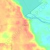
Ivanhoe topographic map

Click on the map to display elevation.

About this map

Name: Ivanhoe topographic map, elevation, terrain.

Location: Ivanhoe, Tyler County, Texas, 77624, United States (30.66618 -94.43296 30.69324 -94.39297)

Average elevation: 60 m

Minimum elevation: 40 m

Maximum elevation: 86 m

Other topographic maps

Click on a map to view its topography, its elevation and its terrain.

Fox Landing

United States > Texas > Tyler County

Average elevation: 34 m

Colmesneil

United States > Texas > Tyler County

Average elevation: 89 m

Town Bluff

United States > Texas > Tyler County

Average elevation: 45 m

Woodville

United States > Texas > Tyler County

Average elevation: 84 m

Gear up for your next adventure:

👖Convertible Hiking Trousers - Zip-off legs to adapt to changing temperatures throughout the day
🎽Hiking Clothing - Breathable clothing for hiking
🔥Windproof Plasma Lighters - USB rechargeable lighters that work in high-altitude winds
🛰️Handheld GPS Units - Rugged GPS devices for tracking coordinates and elevation in the Australian bush
🦶Orthotic Hiking Insoles - Extra arch support for long-distance topographic treks

As an Amazon Associate, this site earns from qualifying purchases at no extra cost to you.