Geolocate

Volcán topographic map

Click on the map to display elevation.

About this map

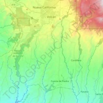
Name: Volcán topographic map, elevation, terrain.

Location: Volcán, Distrito Tierras Altas, Chiriquí, Panama (8.64456 -82.70583 8.79849 -82.62151)

Average elevation: 1,165 m

Minimum elevation: 540 m

Maximum elevation: 2,567 m

Gear up for your next adventure:

🔪Outdoor Multi-tools - Versatile tools for gear repair and survival tasks in the wilderness
🎽Base Layers - Thermal base layers
📟Satellite Messengers - Two-way satellite communication to stay in touch beyond the cellular grid
🛌Sleeping Bags - Sleeping bags for outdoor camping
🏃Compression Recovery Socks - Reduce leg fatigue after heavy days of elevation gain

As an Amazon Associate, this site earns from qualifying purchases at no extra cost to you.