Geolocate

Byfield topographic map

Click on the map to display elevation.

About this map

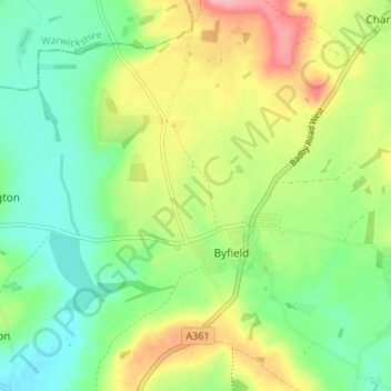
Name: Byfield topographic map, elevation, terrain.

Location: Byfield, West Northamptonshire, England, United Kingdom (52.15997 -1.28125 52.20104 -1.22817)

Average elevation: 154 m

Minimum elevation: 111 m

Maximum elevation: 222 m

Other topographic maps

Click on a map to view its topography, its elevation and its terrain.

Gear up for your next adventure:

🔪Camping Knives - Multi-purpose outdoor knives
🎒Daypacks - Compact backpacks for short hikes
🕶️Polarized Outdoor Sunglasses - Reduce glare from rocks and water for better visual navigation
🔦Headlamps - Hands-free lighting for hiking
🗺️Topographic Maps - Detailed maps for hiking and navigation

As an Amazon Associate, this site earns from qualifying purchases at no extra cost to you.