
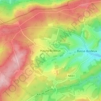
Haute-Bodeux topographic map
Interactive map
Click on the map to display elevation.
About this map
Name: Haute-Bodeux topographic map, elevation, terrain.
Average elevation: 423 m
Minimum elevation: 311 m
Maximum elevation: 529 m
Other topographic maps
Click on a map to view its topography, its elevation and its terrain.
Bütgenbach
Bütgenbach, Verviers, Liège, Wallonia, 4750, Belgium
Average elevation: 575 m
Francorchamps
Belgium > Liège > Verviers > Francorchamps
Francorchamps, Stavelot, Verviers, Liège, Wallonia, 4970, Belgium
Average elevation: 482 m