Geolocate

Dumingag topographic map

Click on the map to display elevation.

About this map
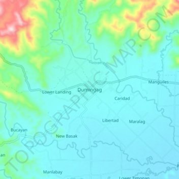
Name: Dumingag topographic map, elevation, terrain.

Location: Dumingag, Zamboanga del Sur, Zamboanga Peninsula, 7028, Philippines (8.11449 123.30484 8.19449 123.38484)

Average elevation: 102 m

Minimum elevation: 28 m

Maximum elevation: 476 m

Other topographic maps

Click on a map to view its topography, its elevation and its terrain.

Midsalip

Philippines > Zamboanga del Sur

Average elevation: 363 m

Sominot

Philippines > Zamboanga del Sur

Average elevation: 261 m

Midsalip

Philippines > Zamboanga del Sur

Average elevation: 363 m

Gear up for your next adventure:

🎽Base Layers - Thermal base layers
🔦Headlamps - Hands-free lighting for hiking
🧢Wide Brim Sun Hats - Maximum coverage for the face and neck while out in the open
🧺Waterproof Dry Sacks - Organize your pack and keep electronics safe from rain and river crossings
☕Outdoor Coffee Makers - Enjoy quality coffee at the summit of your favorite peak

As an Amazon Associate, this site earns from qualifying purchases at no extra cost to you.