Geolocate

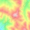
Swan Valley topographic map

Click on the map to display elevation.

About this map

Name: Swan Valley topographic map, elevation, terrain.

Location: Swan Valley, Bonneville County, Idaho, 83449, United States (43.41135 -111.44924 43.48391 -111.24961)

Average elevation: 1,821 m

Minimum elevation: 1,580 m

Maximum elevation: 2,562 m

Other topographic maps

Click on a map to view its topography, its elevation and its terrain.
Palisades

United States > Idaho > Bonneville County

Average elevation: 1,762 m

Ririe Dam

United States > Idaho > Bonneville County

Average elevation: 1,585 m

Black Mountain

United States > Idaho > Bonneville County

Average elevation: 2,471 m

Ririe Reservoir

United States > Idaho > Bonneville County

Average elevation: 1,720 m

Mount Baldy

United States > Idaho > Bonneville County

Average elevation: 2,089 m

Wheaton Mountain

United States > Idaho > Bonneville County

Average elevation: 1,855 m

Gear up for your next adventure:

🧥Thermal Emergency Blankets - Compact Mylar blankets to prevent hypothermia if stranded overnight
📍Handheld GPS - GPS devices for hiking and navigation
🧳Outdoor Travel Organizers - Gear organization accessories
🕶️Polarized Outdoor Sunglasses - Reduce glare from rocks and water for better visual navigation
⌚Altimeter Watches - Watches with altitude tracking

As an Amazon Associate, this site earns from qualifying purchases at no extra cost to you.