Geolocate

Palmares topographic map

Click on the map to display elevation.

About this map
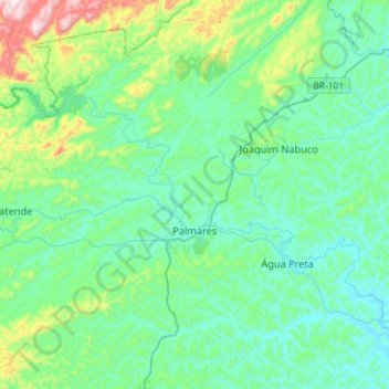
Name: Palmares topographic map, elevation, terrain.

Location: Palmares, Região Geográfica Imediata de Palmares, Região Geográfica Intermediária do Recife, Pernambuco, Northeast Region, Brazil (-8.80100 -35.72100 -8.51700 -35.53700)

Average elevation: 200 m

Minimum elevation: 63 m

Maximum elevation: 798 m

Gear up for your next adventure:

🔥Ferrocerium Rod Fire Starters - Reliable fire lighting in wet or windy conditions without matches
🎒Tactical Waist Packs - Quick access to your compass, phone, and snacks while walking
📦Crushproof Equipment Cases - Safe transport for sensitive surveying and mapping instruments
🧢Outdoor Sun Hats - Sun protection hats for hiking
🔋Rechargeable Batteries - Eco-friendly power for high-drain GPS units and flashlights

As an Amazon Associate, this site earns from qualifying purchases at no extra cost to you.