
Bütgenbach topographic map
Interactive map
Click on the map to display elevation.
About this map
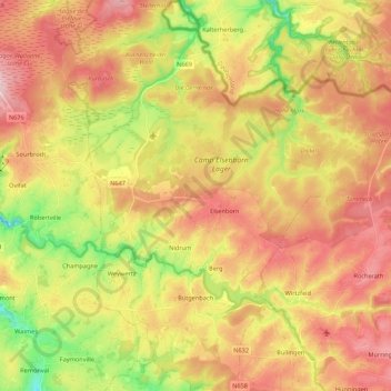
Name: Bütgenbach topographic map, elevation, terrain.
Location: Bütgenbach, Verviers, Liège, Wallonia, 4750, Belgium (50.39383 6.13073 50.53112 6.30189)
Average elevation: 575 m
Minimum elevation: 453 m
Maximum elevation: 681 m
Other topographic maps
Click on a map to view its topography, its elevation and its terrain.