
Sulęcin County topographic map
Interactive map
Click on the map to display elevation.
About this map
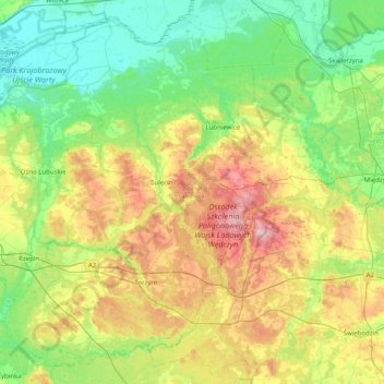
Name: Sulęcin County topographic map, elevation, terrain.
Location: Sulęcin County, Lubusz Voivodeship, Poland (52.20483 14.64731 52.65208 15.44974)
Average elevation: 76 m
Minimum elevation: 10 m
Maximum elevation: 224 m