
Xiwenzhuang topographic map
Interactive map
Click on the map to display elevation.
About this map
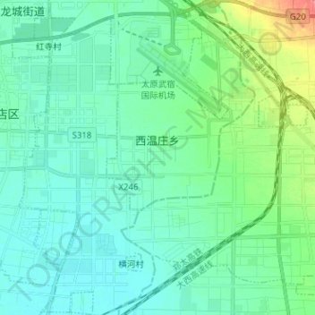
Name: Xiwenzhuang topographic map, elevation, terrain.
Location: Xiwenzhuang, Xiaodian District, Taiyuan City, Shanxi, China (37.67111 112.57213 37.77108 112.66121)
Average elevation: 778 m
Minimum elevation: 765 m
Maximum elevation: 829 m
Other topographic maps
Click on a map to view its topography, its elevation and its terrain.
Xiaodian District
China > Shanxi > Taiyuan City
Xiaodian District, Taiyuan City, Shanxi, China
Average elevation: 826 m