Geolocate

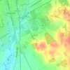
Venus topographic map

Click on the map to display elevation.

About this map

Name: Venus topographic map, elevation, terrain.

Location: Venus, Johnson County, Texas, 76084, United States (32.38686 -97.15672 32.46605 -97.06967)

Average elevation: 200 m

Minimum elevation: 177 m

Maximum elevation: 223 m

Other topographic maps

Click on a map to view its topography, its elevation and its terrain.
Turkey Peak

United States > Texas > Johnson County > Burleson

Average elevation: 237 m

Highland

United States > Texas > Johnson County

Average elevation: 198 m

Oak Hill

United States > Texas > Johnson County > Cleburne

Average elevation: 240 m

Gear up for your next adventure:

🔋Rechargeable Batteries - Eco-friendly power for high-drain GPS units and flashlights
🦶Orthotic Hiking Insoles - Extra arch support for long-distance topographic treks
🧺Waterproof Dry Sacks - Organize your pack and keep electronics safe from rain and river crossings
🧭Global Orienteering Compass - High-precision liquid-filled compasses for accurate map reading and navigation
🛠️Outdoor Repair Kits - Gear repair kits

As an Amazon Associate, this site earns from qualifying purchases at no extra cost to you.