Geolocate

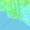
Vitali topographic map

Click on the map to display elevation.

About this map

Name: Vitali topographic map, elevation, terrain.

Location: Vitali, Zamboanga City, Zamboanga Peninsula, 7000, Philippines (7.35038 122.26788 7.39038 122.30788)

Average elevation: 25 m

Minimum elevation: 1 m

Maximum elevation: 142 m

Other topographic maps

Click on a map to view its topography, its elevation and its terrain.

Sacol Island

Philippines > Zamboanga City

Average elevation: 6 m

Vitali River

Philippines > Zamboanga City > Mangusu

Average elevation: 27 m

Sinunug Island

Philippines > Zamboanga City

Average elevation: 0 m

Plaza Pershing

Philippines > Zamboanga City

Average elevation: 4 m

Gear up for your next adventure:

🛌Sleeping Mats - Insulated mats for camping comfort
🦯Adjustable Trekking Poles - Reduce impact on knees when descending steep topographic ridges
🏫Topographic World Globes - 3D physical relief globes to understand global geography
🩹Wilderness First Aid Kits - Comprehensive medical kits tailored for hiking and remote exploration
🎨Portable Watercolor Kits - Paint the landscapes and topographic views you discover

As an Amazon Associate, this site earns from qualifying purchases at no extra cost to you.