Geolocate

Covington topographic map

Click on the map to display elevation.

About this map

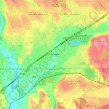
Name: Covington topographic map, elevation, terrain.

Location: Covington, King County, Washington, 98042, United States (47.34401 -122.14398 47.38727 -122.05882)

Average elevation: 137 m

Minimum elevation: 89 m

Maximum elevation: 188 m

Other topographic maps

Click on a map to view its topography, its elevation and its terrain.

Somerset

United States > Washington > King County > Bellevue

Average elevation: 131 m

Riverton

United States > Washington > King County > Tukwila

Average elevation: 77 m

Gear up for your next adventure:

🔑Heavy Duty Carabiners - Secure gear to the outside of your pack for easy access
🧼Biodegradable Soap - Eco-friendly outdoor soap
🛌Sleeping Bags - Sleeping bags for outdoor camping
🛌Compact Down Sleeping Bags - Warmth without the bulk, ideal for backcountry camping
📡Satellite Messengers - Emergency communication devices

As an Amazon Associate, this site earns from qualifying purchases at no extra cost to you.