Geolocate

Huntly topographic map

Click on the map to display elevation.

About this map

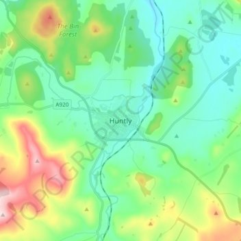
Name: Huntly topographic map, elevation, terrain.

Location: Huntly, Aberdeenshire, Scotland, AB54 8AE, United Kingdom (57.40748 -2.82642 57.48748 -2.74642)

Average elevation: 171 m

Minimum elevation: 91 m

Maximum elevation: 387 m

Gear up for your next adventure:

🖼️Scratch-off Australia Map - Track the regions and peaks you have explored geographically
🚴Bike GPS - GPS devices for cycling
🪢Paracord - Multi-purpose survival cord
🦘Outback Survival Gear - Essential gear for Australian outback
🎒Daypacks - Compact backpacks for short hikes

As an Amazon Associate, this site earns from qualifying purchases at no extra cost to you.