Geolocate

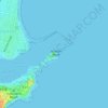
Newcastle topographic map

Click on the map to display elevation.

About this map
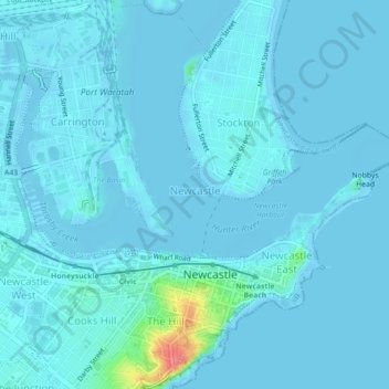
Name: Newcastle topographic map, elevation, terrain.

Location: Newcastle, Newcastle-Maitland, New South Wales, 2300, Australia (-32.93781 151.75963 -32.90148 151.80393)

Average elevation: 5 m

Minimum elevation: -3 m

Maximum elevation: 76 m

New South Wales trails, hiking, mountain biking, running and outdoor activities

Other topographic maps

Click on a map to view its topography, its elevation and its terrain.

Jesmond Park

Australia > New South Wales > Newcastle

Average elevation: 35 m

Cameron Park

Australia > New South Wales > Newcastle

Average elevation: 23 m

Glenrock Lagoon

Australia > New South Wales > Newcastle

Average elevation: 39 m

Nobbys Beach

Australia > New South Wales > Newcastle

Average elevation: 3 m

Redhead Bluff

Australia > New South Wales > Newcastle

Average elevation: 13 m

Dixon Park

Australia > New South Wales > Newcastle

Average elevation: 12 m

Gear up for your next adventure:

🎒Daypacks - Compact backpacks for short hikes
🧳Outdoor Travel Organizers - Gear organization accessories
🏃Compression Recovery Socks - Reduce leg fatigue after heavy days of elevation gain
📡Weather Radios - Emergency weather radios
🍳Camping Cookware - Cookware sets for outdoor meals

As an Amazon Associate, this site earns from qualifying purchases at no extra cost to you.