
Rio Grande do Norte topographic map
Interactive map
Click on the map to display elevation.
About this map
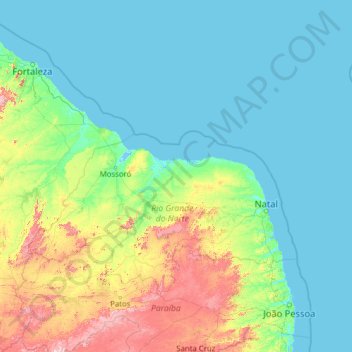
Name: Rio Grande do Norte topographic map, elevation, terrain.
Location: Rio Grande do Norte, Northeast Region, Brazil (-6.98273 -38.58210 -3.64890 -33.61519)
Average elevation: 126 m
Minimum elevation: -3 m
Maximum elevation: 1,099 m