

Rain topographic map
Click on the map to display elevation.
Rain
The major cause of rain production is moisture moving along three-dimensional zones of temperature and moisture contrasts known as weather fronts. If enough moisture and upward motion is present, precipitation falls from convective clouds (those with strong upward vertical motion) such as cumulonimbus (thunder clouds) which can organize into narrow rainbands. In mountainous areas, heavy precipitation is possible where upslope flow is maximized within windward sides of the terrain at elevation which forces moist air to condense and fall out as rainfall along the sides of mountains. On the leeward side of mountains, desert climates can exist due to the dry air caused by downslope flow which causes heating and drying of the air mass. The movement of the monsoon trough, or intertropical convergence zone, brings rainy seasons to savannah climes.
About this map
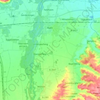
Name: Rain topographic map, elevation, terrain.
Location: Rain, Rain (Schwaben), Danube-Ries, Bavaria, 86641, Germany (48.60915 10.87135 48.72124 11.03955)
Average elevation: 414 m
Minimum elevation: 386 m
Maximum elevation: 486 m