Geolocate

Senoia topographic map

Click on the map to display elevation.

About this map
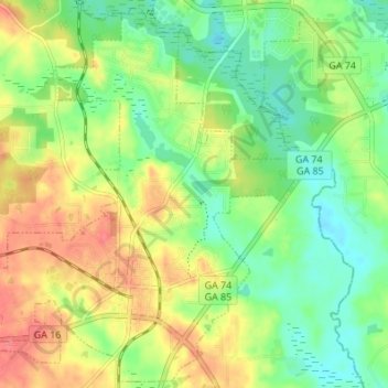
Name: Senoia topographic map, elevation, terrain.

Location: Senoia, Coweta County, Georgia, United States (33.28713 -84.59043 33.34199 -84.52233)

Average elevation: 248 m

Minimum elevation: 219 m

Maximum elevation: 285 m

Gear up for your next adventure:

🧴SPF 50+ Bulk Sunscreen - Maximum protection for long-term outdoor exposure
🧦Hiking Socks - Comfortable socks for long hikes
👕UPF 50+ Sun Shirts - Essential protection against the harsh Australian sun during field work
🏕️Camping Gear - Essential camping equipment
🥾Hiking Boots - Durable hiking boots for trails and rough terrain

As an Amazon Associate, this site earns from qualifying purchases at no extra cost to you.