Geolocate

Poway topographic map

Click on the map to display elevation.

About this map

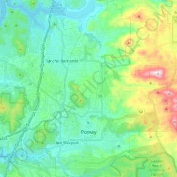
Name: Poway topographic map, elevation, terrain.

Location: Poway, San Diego County, California, 92064, United States (32.92716 -117.08435 33.06641 -116.94061)

Average elevation: 275 m

Minimum elevation: 86 m

Maximum elevation: 867 m

Gear up for your next adventure:

🧭Military Style Lensatic Compass - Durable sighting compasses for advanced land navigation and surveying
🎒Tactical Waist Packs - Quick access to your compass, phone, and snacks while walking
🆘Personal Locator Beacons (PLB) - Satellite emergency beacons for life-saving help in areas with no mobile coverage
🌬️Windbreaker Jackets - Wind protection jackets
🎨Portable Watercolor Kits - Paint the landscapes and topographic views you discover

As an Amazon Associate, this site earns from qualifying purchases at no extra cost to you.