Geolocate

Cambridge topographic map

Click on the map to display elevation.

About this map

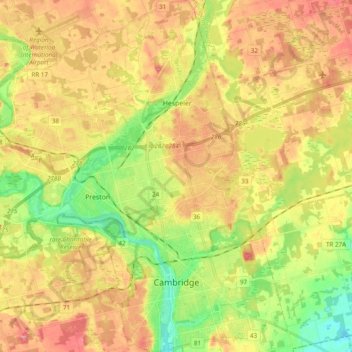
Name: Cambridge topographic map, elevation, terrain.

Location: Cambridge, Region of Waterloo, Ontario, Canada (43.33239 -80.41308 43.47234 -80.25149)

Average elevation: 304 m

Minimum elevation: 256 m

Maximum elevation: 348 m

Gear up for your next adventure:

🧥Down Jackets - Insulated jackets for cold weather
🦘Outback Survival Gear - Essential gear for Australian outback
🧢Outdoor Sun Hats - Sun protection hats for hiking
👣Snake & Scrub Gaiters - Protection against spinifex, mud, and snakes while walking off-track
🧥Thermal Emergency Blankets - Compact Mylar blankets to prevent hypothermia if stranded overnight

As an Amazon Associate, this site earns from qualifying purchases at no extra cost to you.