Geolocate

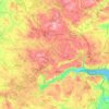
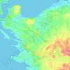
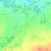
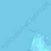
Gørding topographic map

Click on the map to display elevation.

About this map

Name: Gørding topographic map, elevation, terrain.

Location: Gørding, Esbjerg Municipality, Region of Southern Denmark, 6690, Denmark (55.45342 8.77995 55.49342 8.81995)

Average elevation: 21 m

Minimum elevation: 9 m

Maximum elevation: 39 m

Other topographic maps

Click on a map to view its topography, its elevation and its terrain.

Funen

Denmark > Region of Southern Denmark

Average elevation: 19 m

Funen

Denmark > Region of Southern Denmark

Average elevation: 19 m

Funen

Denmark > Region of Southern Denmark

Average elevation: 19 m

Rømø

Denmark > Region of Southern Denmark

Average elevation: 0 m

Funen

Denmark > Region of Southern Denmark

Average elevation: 19 m

Skarø

Denmark > Region of Southern Denmark

Average elevation: 0 m

Guldbjerg

Denmark > Region of Southern Denmark

Average elevation: 23 m

Ærø

Denmark > Region of Southern Denmark

Average elevation: 3 m

Egholm

Denmark > Region of Southern Denmark

Average elevation: 0 m

Funen

Denmark > Region of Southern Denmark

Average elevation: 19 m

Funen

Denmark > Region of Southern Denmark

Average elevation: 19 m

Gear up for your next adventure:

📱Tablet Tripod Mounts - Steady platforms for viewing digital maps or taking long exposures
🌿Flora and Fauna Field Guides - Identify the plants and animals you encounter on your route
📸Action Cameras - Record your journey across interesting topographic features in 4K
🗺️Topographic Maps - Detailed maps for hiking and navigation
🧦Hiking Socks - Comfortable socks for long hikes

As an Amazon Associate, this site earns from qualifying purchases at no extra cost to you.