Geolocate

Baildon topographic map

Click on the map to display elevation.

About this map
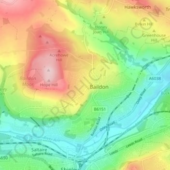
Name: Baildon topographic map, elevation, terrain.

Location: Baildon, Bradford, West Yorkshire, England, United Kingdom (53.83714 -1.80701 53.86893 -1.73604)

Average elevation: 147 m

Minimum elevation: 55 m

Maximum elevation: 282 m

Other topographic maps

Click on a map to view its topography, its elevation and its terrain.

Baildon

United Kingdom > England > Bradford > Baildon > Baildon

Average elevation: 164 m

Gear up for your next adventure:

📚Map Reading & Navigation Guides - Master the art of interpreting topographic contours and symbols
📕Hiking Guide Books - Guides for hiking trails
🛌Sleeping Mats - Insulated mats for camping comfort
🎒Daypacks - Compact backpacks for short hikes
🧊Insulated Stainless Steel Flasks - Keep water cold for 24 hours in the heat or coffee hot in the cold

As an Amazon Associate, this site earns from qualifying purchases at no extra cost to you.