
Roermond topographic map
Click on the map to display elevation.
About this map
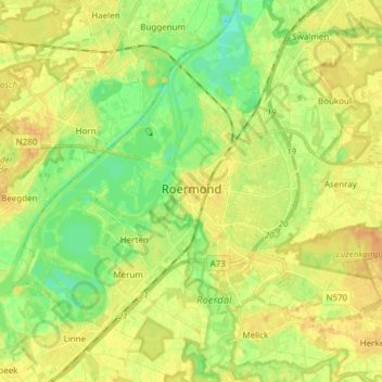
Name: Roermond topographic map, elevation, terrain.
Location: Roermond, Limburg, Netherlands (51.16054 5.92125 51.22499 6.07314)
Average elevation: 25 m
Minimum elevation: 9 m
Maximum elevation: 38 m
Other topographic maps
Click on a map to view its topography, its elevation and its terrain.