Geolocate
👉 Easily get elevation data in JSON, GeoTIFF and KML formats using Elevation API
Thank you for supporting this site ❤️
Make a donation

Canton topographic map

Click on the map to display elevation.

About this map

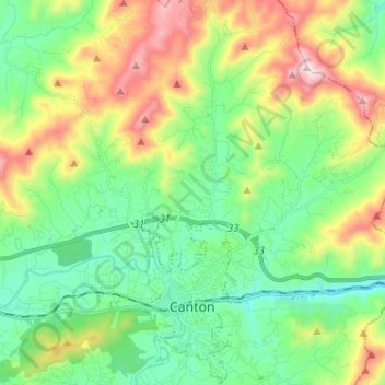
Name: Canton topographic map, elevation, terrain.

Location: Canton, Haywood County, North Carolina, United States (35.51170 -82.86488 35.61591 -82.79655)

Average elevation: 942 m

Minimum elevation: 702 m

Maximum elevation: 1,435 m

Gear up for your next adventure:

🧢Outdoor Sun Hats - Sun protection hats for hiking
🧢Wide Brim Sun Hats - Maximum coverage for the face and neck while out in the open
🥤Hydration Packs - Hydration systems for hiking
🥾Hiking Boots - Durable hiking boots for trails and rough terrain
Outdoor Coffee Makers - Enjoy quality coffee at the summit of your favorite peak

As an Amazon Associate, this site earns from qualifying purchases at no extra cost to you.