
Thank you for supporting this site ❤️
Make a donation
Make a donation
Gear up for your next adventure:
As an Amazon Associate, this site earns from qualifying purchases at no extra cost to you.
Hamburg-Mitte topographic map
Click on the map to display elevation.
Thank you for supporting this site ❤️
Make a donation
Make a donation
Gear up for your next adventure:
As an Amazon Associate, this site earns from qualifying purchases at no extra cost to you.
About this map
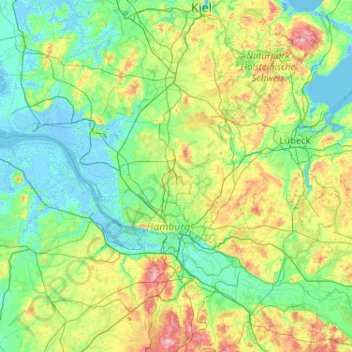
Name: Hamburg-Mitte topographic map, elevation, terrain.
Location: Hamburg-Mitte, Hamburg, Germany (53.45388 8.10450 54.02765 10.16878)
Average elevation: 26 m
Minimum elevation: -6 m
Maximum elevation: 157 m
Thank you for supporting this site ❤️
Make a donation
Make a donation
Gear up for your next adventure:
As an Amazon Associate, this site earns from qualifying purchases at no extra cost to you.